
- News
- Science
The World Meteorological Organization has warned many regions are expected to experience warmer-than-normal conditions
Olivia Le PoidevinThursday 04 December 2025 10:38 GMTComments CloseAerials show scale of flooding in Indonesia as national disaster try to reach affected areas
Sign up for our free Health Check email to receive exclusive analysis on the week in health
Get our free Health Check email
Get our free Health Check email
Email*SIGN UPI would like to be emailed about offers, events and updates from The Independent. Read our Privacy notice
A weak La Niña phenomenon is set to influence global weather patterns over the next three months, according to a new prediction from the World Meteorological Organization (WMO).
Despite La Niña typically involving a temporary cooling of temperatures in the central and eastern Pacific Ocean, the WMO warns that many regions worldwide are still expected to experience warmer-than-normal conditions. This shift increases the likelihood of severe floods and droughts, which could significantly impact agricultural crops.
The WMO estimates a 55 per cent probability of a weak La Niña persisting from this month until February next year. Recent oceanic and atmospheric indicators suggest borderline La Niña conditions are already present.
Looking further ahead, the organisation also forecasts a 65 to 75 per cent chance of a return to neutral conditions for the periods of January to March and February to April in 2026.
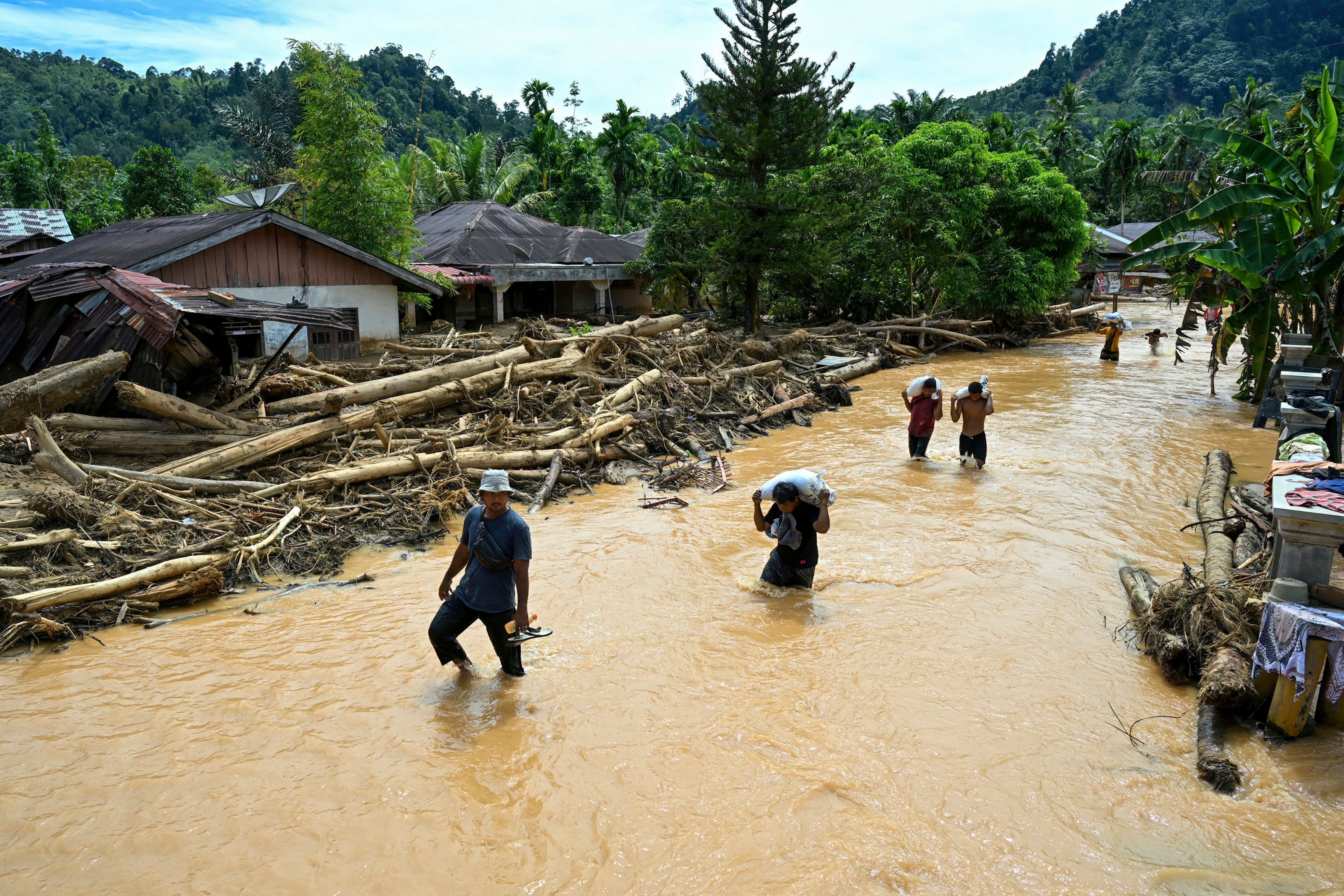 People wade through the floodwater in the aftermath of flash floods at Tukka village, Central Tapanuli, North Sumatra province, Indonesia (AFP via Getty Images)
In the United States, La Nina often means more precipitation — including possible snowstorms — in northern areas and winter dryness in the South. It can bring heavier rains in Indonesia, the Philippines, parts of Australia, Central America, northern South America and southeastern Africa.
It also can mean drought in the Middle East, eastern Argentina, eastern China, Korea and southern Japan, meteorologists said.
A La Nina occurs when certain parts of the Central Pacific Ocean cool by half a degree Celsius (0.9 degrees Fahrenheit) compared to normal. The National Oceanic and Atmospheric Administration declared in October that La Nina conditions had formed.
But it’s likely to be not very strong and may disappear in the next few months, based on multi-factor computer model forecasts by NOAA and Columbia University, said Michelle L'Heureux, lead scientist on the NOAA team that studies both La Nina and El Nino.
"There is a three out of four chance it will remain a weak event," L'Heureux said in an email. “A weaker event tends to exert less of an influence on the global circulation, so it's possible there will be surprises ahead.”
The U.N. weather agency said it is not likely there will be an El Nino, a natural climate phenomenon that fuels tropical cyclones in the Pacific and boosts rainfall and flood risk in parts of the Americas and elsewhere.
Seasonal forecasts and their impact on weather can translate into millions of dollars of economic savings for agriculture, energy, health and transport, said the WMO, adding thousands of lives can also be saved by preparing response actions.
More about
La NinaWMOWeather patternsPacific OceanClimate crisisEl NinoJoin our commenting forum
Join thought-provoking conversations, follow other Independent readers and see their replies
Comments


